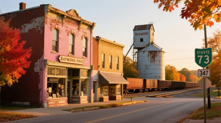

Complete Guide: Raymond, OH to Columbus, OH Travel
For residents of Raymond, the trip to Columbus isn’t just another drive – it’s a lifeline connecting small-town charm with big-city opportunities. I’ve made this journey countless times over the years, watching cornfields gradually give way to Columbus’ skyline. What used to be a straightforward country drive has transformed into a corridor of growing importance. With new housing developments popping up near Route 3 and major employers like Honda expanding operations, this route now carries over 15,000 daily commuters according to ODOT traffic data.
Why this matters in 2024: Recent infrastructure changes have reshaped travel patterns. The US-33 SmartLane project completed last spring now uses AI-powered traffic sensors to dynamically adjust speed limits during rush hours. Meanwhile, COTA’s new micro-transit pilot connects Raymond’s park-and-ride lot with downtown Columbus via on-demand shuttles – a game-changer for those avoiding downtown parking nightmares.
Understanding the Route: Beyond the Map
The Evolving Geography
Raymond’s position 38 miles northwest of Columbus (measured from the town square to the Statehouse) places it firmly in Columbus’ expanding commuter belt. But this isn’t just point A to B – it’s a journey through changing landscapes. You’ll start in Madison County’s agricultural heartland, pass through Union County’s growing suburbs, and finally enter Franklin County’s urban expanse. The elevation gradually drops about 300 feet along the route, something you’ll notice on those rare icy mornings when the hills near Chuckery become extra challenging.
Navigation Deep Dive
While Google Maps suggests the “fastest” route, experienced commuters know three viable paths:
- The Express Route (US-33 East): 38 miles, 42 minutes average
- The Scenic Route (Route 3 to London-Plain City Rd): 44 miles, 55 minutes
- The Hybrid Route (Route 142 to I-70): 41 miles, 48 minutes
Pro tip: Create custom avoidances in Waze – I always bypass the I-270 interchange between 4-6 PM where afternoon backups regularly stretch 2 miles.
Landmarks Worth the Stop
Scioto River Overlook (Mile 18)
Perfect sunrise photo spot with portable coffee vendors most mornings
Histralia Diner (Mile 22)
1950s-style breakfast spot famous for their “Commuters Omelet”
Darby Creek Wetlands (Mile 29)
Nature boardwalk with spotting scopes for birdwatching
Transportation Face-Off: Choosing Your Best Option
The Car Commuter’s Toolkit
Driving remains the most popular choice (72% according to ODOT surveys), but smart drivers optimize their trips:
- Fuel Efficiency: At current Ohio gas prices ($3.49/gal avg), a fuel-efficient sedan costs $5.20/trip while SUVs run $8.75
- Carpool Strategy: Columbus’ new “Smart Mobility” lanes give HOVs priority during rush hours
- Parking Hacks: The Chestnut Street Garage offers $5/day early-bird special before 7:30 AM
Public Transit Unlocked
COTA’s Route 102 isn’t just a bus – it’s a mobile office for regulars:
- Free WiFi and charging ports at every seat
- Express buses skip 15 stops, saving 25 minutes
- New bike racks accommodate cyclists doing “multi-modal” commutes
The secret weapon? The COTA Transit app’s “Guaranteed Ride Home” program covering emergency Uber costs if you work late.
Rideshare Reality Check
While UberX averages $32 for this route, consider these 2024 changes:
- Uber Comfort now includes Columbus airport tolls in pricing
- Lyft’s “Shared Saver” option cuts costs 40% with 1-2 quick pickups
- Always check both apps – price differences often exceed $8 during peak times
| Option | Cost Range | Travel Time | Stress Factor | Best For |
|---|---|---|---|---|
| Personal Vehicle | $5.20-$8.75 | 35-65 min | Medium (traffic dependent) | Families, errand-runners |
| COTA Express Bus | $2.50 (single) / $70 (monthly) | 55-75 min | Low | Budget travelers, students |
| Uber/Lyft | $28-$58 | 35-70 min | Very Low | Business travel, special events |
| Biking (electric assist) | Free (charging cost) | 100-120 min | Medium-High | Fitness enthusiasts, eco-commuters |
Mastering the Journey: Pro Commuter Strategies
Time-Saving Tactics
After three years of daily commutes, I’ve perfected these techniques:
- The 7:12 AM Sweet Spot: Departing at this precise time avoids both school buses and downtown gridlock
- Podcast Positioning: Pre-download content – cell service drops near Big Darby Creek
- Alternative Fuel Stops: Sheetz in Hilliard has the cheapest ethanol-free gas along the route
Construction Alert: The I-70/Route 42 interchange project (running through October 2024) adds 12-18 minutes to hybrid routes. Sign up for ODOT text alerts at transportation.ohio.gov for real-time detour updates.
Weather-Proofing Your Trip
Ohio weather requires specialized preparation:
| Condition | Time Impact | Essential Gear | Route Adjustment |
|---|---|---|---|
| Heavy Snow | +50-70% travel time | Snow socks (better than chains), thermal blanket | Stick to main highways (better plowed) |
| Torrential Rain | +30% time, +300% stress | New wiper blades, defogger treatment | Avoid Route 142 (flood-prone areas) |
| Dense Fog | +40% time | Yellow fog lights, windshield water repellent | Use Route 3 (wider shoulders) |
The Savvy Commuter’s Packing List
Beyond the obvious phone charger, keep these in your vehicle:
- Emergency Kit: Jumper cables, tire inflator, roadside flares
- Comfort Items: Insulated water bottle, neck pillow for traffic jams
- Productivity Tools: Dashboard phone mount, hands-free dictation app
- Local Perks: “Frequent Parker” cards for downtown garages
Evolving Your Commute: Future Developments
The Raymond-Columbus corridor is poised for transformation:
- 2025: ODOT’s “Connected Corridor” project will install vehicle-to-infrastructure tech allowing cars to communicate with traffic signals
- 2026: COTA’s planned electric shuttle expansion to Raymond
- Ongoing: Bike lane expansion adding protected paths along 60% of Route 3
Columbus’ Smart City initiatives mean your commute will soon feature:
- Real-time parking availability updates
- Dynamic toll pricing for guaranteed express lane access
- Integrated transit payments via smartphone wallets
Conclusion: Working Smarter, Not Harder
The Raymond-Columbus journey reflects Ohio’s changing landscape – where rural and urban coexist through daily migration. Having navigated this route through blizzards, construction zones, and even the occasional Amish buggy, I’ve learned that the “best” method depends entirely on your day’s mission. Need to transport kids to Nationwide Children’s Hospital? Driving wins. Heading to a Blue Jackets game with friends? Rideshare eliminates parking stress. Job interview downtown? The express bus lets you prepare en route.
Remember these core principles: Always check traffic before leaving (I keep ODOT’s live cam page bookmarked), maintain flexibility in your options (that monthly bus pass pays for itself after just 12 trips), and embrace the journey – whether you’re spotting deer in the morning mist or watching Columbus’ skyline light up at dusk. With smart planning, this corridor becomes less a commute and more a connection between two distinct Ohio experiences.